If you are looking for something to do these holidays/Easter break can I suggest a walk to Barrenjoey Lighthouse. It sits at Sydney’s most northern point – Barrenjoey Head at Palm Beach and is part of the National Parks (so you are unable to take your puppy dogs).
The walk is extremely picturesque and is about 1km to the top. While the walk to the top is easier than it appears, it does require a moderate level of fitness, hence the photo of Eloise on Geoff’s shoulders at the top of the walk. She actually spent most of her childhood on his shoulders on any of our outings.
Parking is available at Governor Phillip car park and this is paid parking, unless you have a Pittwater Council sticker.
Why not pack a BBQ lunch for the end of the walk, you can bring your own BBQ, although since this photo was taken quite a few years ago, gas BBQs have been installed.
You can also visit the Palm Beach Boathouse, which has great coffee!
Have fun and please let me know if you do it and what you think.
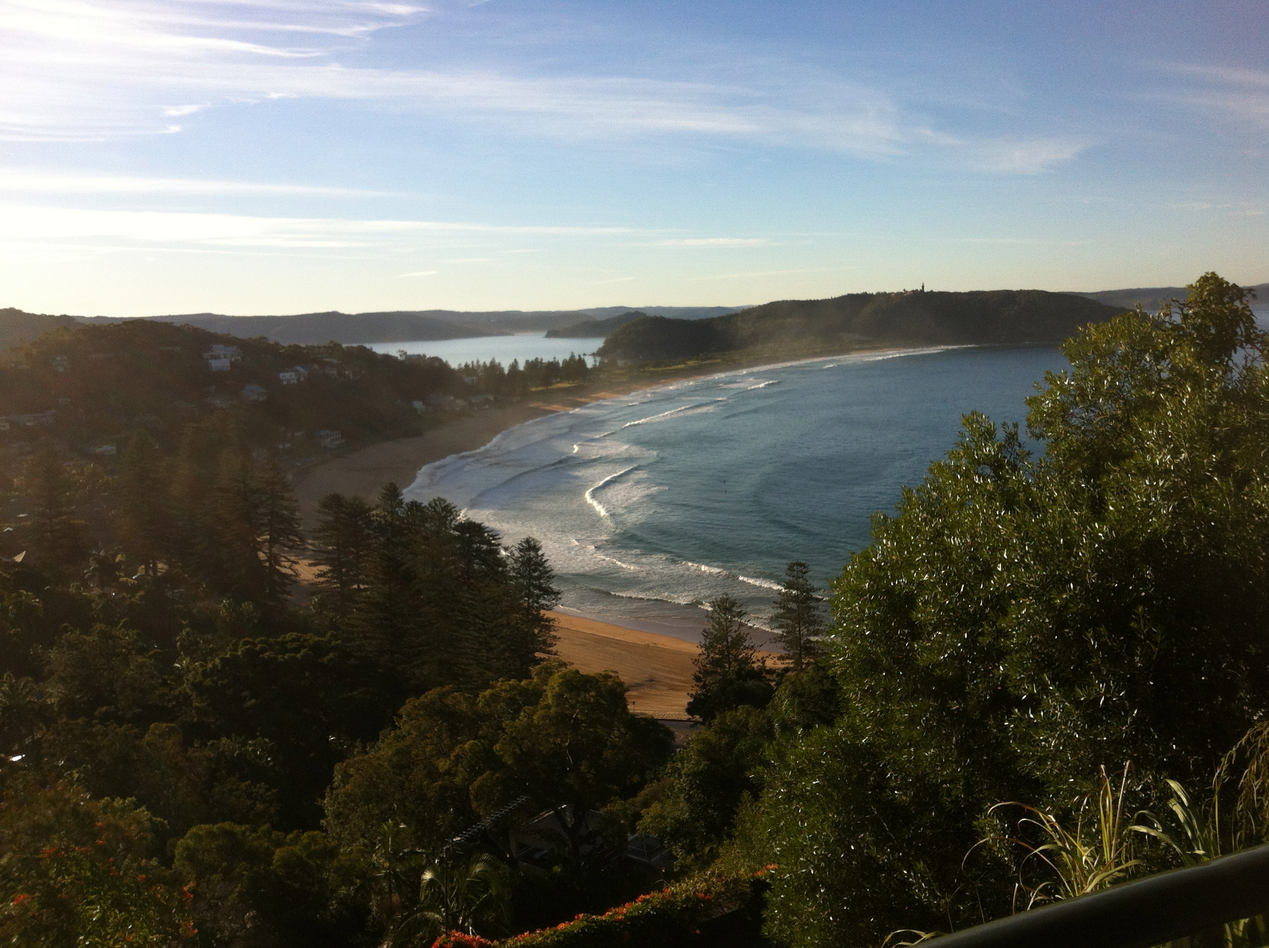
Beautiful Palm BeachLet’s Keep WalkingLooking north from BangalleyView towards Bangalley
We’ve done this walk many times. We take two cars, leave one in the car park at Avalon and drive to Palm Beach. The first time we did it, we (that would be me) left the key for the car at Avalon in the car at Palmy. We discovered this past Whale Beach so Geoff had to do a quick sprint back to the car. Lucky he has done a few half marathons!!
Start at south end of Palm Beach and take rock pool steps, cross Florida Road and turn L and head up driveway (1A Rockridge) to access bush track at the top (it seems like you are entering private property, but keep going) to L (Public Land sign) up to Rock Bath Road.
Continue Rock Bath Road to Pacific Road and turn L (caution – no footpath).
From Pacific Road, L into Norma Road and turn R (caution – no footpath).
Cross Whale Beach Rd and turn R (caution – no footpath).
View over Whale Beach
Follow road for approximately 100m, then turn L down Public Pathway steps to Whale Beach (across from 246 Whale Beach Road). Continue R along Whale Beach following informal path along dunes or on sand.
Alternatively you could keep walking on Whale Beach Road and turn L down Surf Road.
At south end of beach, past rest rooms, R up stairs to Malo Road.
Turn R at Malo Road, then L into Whale Beach Road.
Follow Whale Beach Road past Dophin Bay and Careel Head Roads.
Turn L into bush path and steps to Bangalley Head Reserve (across road from 58 Whale Beach Road).
Stay L following main trail to top of headland. Near top of headland, track junction at rock outcrop marked with green sign at L (south side of signs reads ‘Loop Trail’). Take L fork of track up over rock outcrop past wooden marker post and lookout (there is a cliff edge rock platform with incredible views north to Barrenjoey and beyond!! Caution No hand rail!).
Bangalley HeadlandTop of Bangalley Headland
With our buddies Jules & Kev doing the Sydney Coastrek 50km in 2011
Turn R and continue south along cliff edge track to next track junction (near wooden marker posts).
Turn sharp L into track down south side of Bangalley Headland.
Follow track down to open grassy area at edge of North Avalon cliff line (houses on RHS back onto Watkins Road).
At south end of grassy area, enter bush path that veers L to Marine Parade. Turn L into Marine Parade.
Follow Marine Parade to T-junction, cross Tasman Road in Des Creagh Reserve and follow footpath through to Avalon.
Short section on Barrenjoey Road footpath (20m) past bus stop, then L into Avalon Parade (which becomes Surfside Avenue).
Stop, enjoy the view and relax. You have reached your destination.